
Downloads
Keywords:
Metropolitan Flood Risk Characterization Using Remote Sensing, GIS, and Fuzzy Logic (RS-GIS-Fl) Approach: Suleja, Nigeria
Authors
Abstract
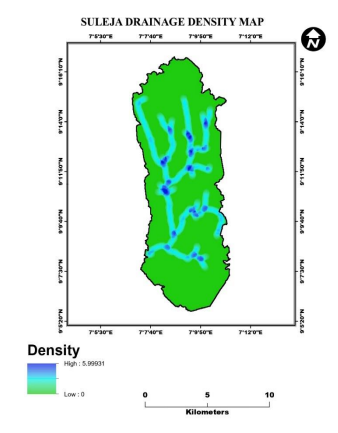
Climate change exacerbates extreme events like floods, droughts, heatwaves, cyclones, hurricanes, tornadoes, and wildfires, affecting human populations and environments worldwide. Despite varying impacts across regions, no area is immune to climate change consequences. To mitigate these effects, this study employs Geographic Information System (GIS), Remote Sensing, and Fuzzy Logic System to map flood vulnerability zones in Suleja Local Government, Niger State, North Central Nigeria. The research integrates satellite and GIS datasets to prepare Suleja's Flood Zonation Mapping. Rainfall data from Nigeria Meteorological Agency (NiMET), Climate Hazards Group InfraRed Precipitation with Station Data (CHRPS), Global Satellite Mapping of Precipitation (GSMaP), and parameters like Slope, Elevation, Nearness to Water Bodies, Land Use Land Cover, and Drainage Density are utilized to identify flood vulnerability. The flood vulnerability map categorizes the area into five zones: Very Low Risk (40.9%), Low Risk (18.9%), Medium Risk (27.6%), High Risk (7.1%), and Very High Risk (5.5%). Considering the stochastic nature of flood characteristics, this study emphasizes the importance of integrating hydro-climatic and physical catchment parameters, leveraging bias-adjusted satellite data to minimize uncertainty. Effective flood management requires quantifying risk, susceptibility, and hazard components to establish a robust control framework. This research contributes to the development of data-driven flood mitigation strategies in vulnerable regions like Suleja. By harnessing GIS, Remote Sensing, and Fuzzy Logic System, policymakers and stakeholders can make informed decisions to protect communities and infrastructure from flood risks.
Article Details
Published
Issue
Section
License

This work is licensed under a Creative Commons Attribution-NonCommercial-ShareAlike 4.0 International License.
